 |
| Source: The Story of St. Petersburg by Karl H. Grismer |
The town of St. Petersburg was incorporated in 1892 ‒ it was re-incorporated as a city in 1903. From 1903 to 1925, the city limits grew in size from less than one square mile to more than fifty square miles, eventually including the Jungle area in 1925.
 |
| The Jungle, St. Petersburg. Vintage Postcard. |
Based on information in "The Story of St. Petersburg" by Karl H. Grismer, here is an outline of the city's expansion:
- 1888 - Original town plat 500 acres, 0.78 square miles
- 1903 - Small subdivisions added, city limits expanded by about two square miles.
- 1912 - Bayboro subdivision added (.28 square miles)
- 1913-14 boom - West Central district (approximately five blocks north and south of Central Avenue along the new street car line to Boca Ciega Bay) and several other extensions increased city to 8.6 square miles.
- 1920 - 2 square miles added north and south of city limits between 16th St and Tampa Bay
- 1925 - 40 square miles added. St. Petersburg's size expanded from 10 square miles to over 50 square miles and the Jungle was now officially within the city limits.
- 1926 - 2 square miles added for a total of 53.22 square miles.
- No additional expansion between 1926 and the book's publication in 1948.
- Additions since 1948 have increased the city limits to 61.7 square miles on land.
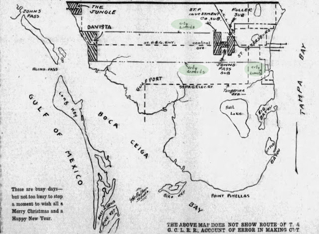
Davista was Annexed to St. Petersburg in 1913
Map of city limits, St. Petersburg Times December 23, 1913. West Central district (a one mile wide strip north and south of Central Avenue along the new street car line) and several other extensions increased the city's area to 8.6 square miles. The shape resembled the letter "T" on its side. The city limits extended west to Boca Ciega Bay and included Davista (today part of the Pasadena section of St. Petersburg). Sunset Park (at Central Avenue and Park Street) was donated to the city by the St. Petersburg Investment Company at this time. The map shows a pier at the Jungle Prada Site. The wooden pier was built in December 1913 according to jungle-terrace.org.
The Issue of Mayor Al Lang's Residence
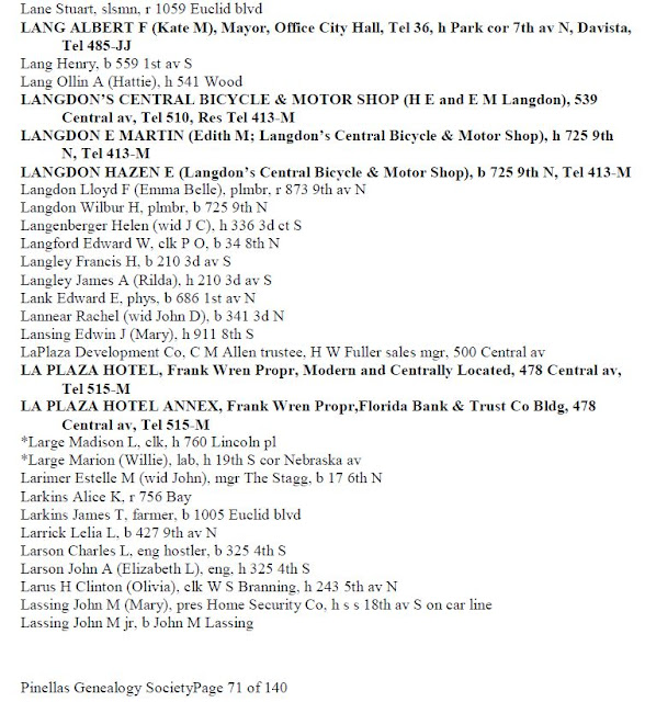
"An amusing situation developed around [Al] Lang's first election [as mayor of St. Petersburg in 1916]. H. Walter Fuller had given him and A F. Thomasson two choice Boca Ciega Bay waterfront lots just north of Fifth Avenue North, if they would build homes and live there. The move of course was to give the struggling new development status and class. But unhappily for Lang, his home was immediately north of the city line, and here he was running for mayor. So he quietly, with the full approval of Fuller, "moved" to an apartment downtown but took many a long "vacation" to the country."
‒ Walter P. Fuller, St. Petersburg and Its People.
1925: The Jungle is annexed to St. Petersburg
 |
| Picturesque Jungle Roadway, St. Petersburg (credit: jungle-terrace.org). |
The Jungle became part of St. Petersburg in April 1925 when a controversial vote was held on the annexation of 40 square miles of land west of St. Petersburg. The vote required a 2/3 majority of those voting to pass, but the election was poorly publicized. A small number of voters showed up and ratified the special resolution. The new city limits increased St. Petersburg's area from 10 square miles to 50 square miles.
 |
| St. Petersburg Times, April 28, 1925. |
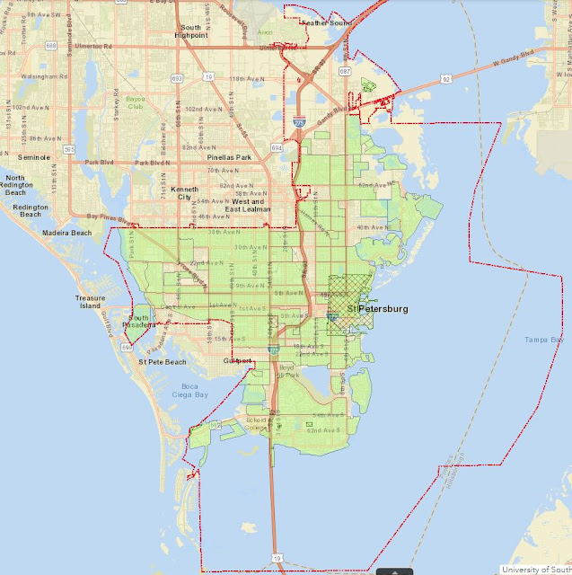
St. Petersburg current city limits (red line)
Wikipedia's Opinion of West St. Petersburg
"The western side of St. Petersburg includes the Grand Central District and Historic Kenwood. The Grand Central District houses the cities [sic] cafes, art galleries, restaurants, and bars all owing to the Renaissance style architecture. Historic Kenwood is filled with art studios and galleries similarly to the Grand Central District."
‒ Wikipedia: St. Petersburg, Florida
Wikipedia's original headquarters were in St. Petersburg, so you'd think they would know something about the geography. The article makes no mention of the territory to the west of Kenwood, even though a Spanish expedition landed there in 1528 and, as noted in this blog, a lot of history was made in the early 20th century in the Jungle neighborhoods. As a matter of fact, Kenwood is on the east side of St. Petersburg.
 |
| Map of St. Petersburg neighborhoods. Kenwood and Grand Central are in the center of the map, not on the west side of St. Petersburg. |
Update 05/24/2021: The Wikipedia entry has been updated (maybe someone read this blog).
The central portion of St. Petersburg includes the Grand Central District and Historic Kenwood. The Grand Central District houses the city's cafes, art galleries, restaurants, and bars all owing to the Craftsman style architecture, Historic Kenwood is filled with art studios and galleries similarly to the Grand Central District. Kenwood was named "Neighborhood of the Year" in 2020 by Neighborhood, USA for revitalization and beautification.
The updated version is an improvement, although every neighborhood west of Kenwood is considered unworthy of comment.
Anyone can edit/update a Wikipedia entry, so it was unfair of this blog to criticize Wikipedia.


